The best way to appreciate the scale of Yellowstone Lake is to see it from the air. Click on the images below for an aerial tour of Yellowstone Lake. Photos by Chris Linder, WHOI. Aerial support provided by LightHawk. Work was completed under an authorized Yellowstone Research Permit.


Chris Boyer opens the hangar doors to reveal his cherry red 1957 Cessna. Chris is a pilot, photographer, and small business owner. He also flies volunteer missions for LightHawk, a group that connects pilots with conservation projects. Work was completed under an authorized Yellowstone Research Permit.
Chris sets a course for the northern portion of Yellowstone Lake, the focus area for the HD-YLAKE project. Aerial support provided by LightHawk. Work was completed under an authorized Yellowstone Research Permit.
An inauspicious start: minutes after taking off, we could smell the acrid fumes from numerous forest fires. The haze from the smoke made the otherwise clear Montana skies resemble a scene from the Great Smoky Mountains. Aerial support provided by LightHawk.Work was completed under an authorized Yellowstone Research Permit.
These aren't forest fires, but rather plumes of steam from the numerous geothermal features just north of Yellowstone Lake, on the banks of the Yellowstone River. Aerial support provided by LightHawk. Work was completed under an authorized Yellowstone Research Permit.
Visitors marvel at the colorful pools and bubbling springs along the shore of Yellowstone Lake at the West Thumb geyser basin. What they may not appreciate is that the pools they are looking at are just a small part of a larger-scale system that extends across the entire northern half of the lake. Aerial support provided by LightHawk. Work was completed under an authorized Yellowstone Research Permit.
A hazy sunrise struggles to light the surface of Yellowstone Lake. The lake is the largest freshwater lake above 7,000 feet in North America, with over 110 miles of shoreline. The northern half of the lake lies in the geothermally active Yellowstone Caldera. Aerial support provided by LightHawk. Work was completed under an authorized Yellowstone Research Permit.
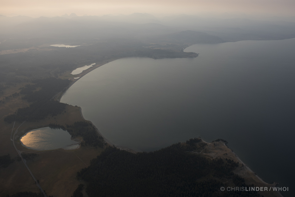
If the pressure suddenly drops on a large quantity of near-boiling water, the liquid flashes to steam, causing a steam explosion. If the large quantity of near-boiling water is below the ground surface then this process creates a hydrothermal explosion. Yellowstone Lake hosts the world’s largest collection of hydrothermal explosion craters, including the Mary Bay crater (the bay with small ponds behind it in this picture), which is about 1-1/2 miles in diameter and over 350 feet deep. Aerial support provided by LightHawk. Work was completed under an authorized Yellowstone Research Permit.
The HD-YLAKE focus site is located just east of Stevenson Island, where hot fluids discharge into the lake along a set of fissures that extend away from the island. The hot fluids dissolve silica from the lake floor sediments (mud), creating pockmarks and deep holes on the bottom. The deep holes provide a unique opportunity to acquire fluid samples that are extremely hot (more than 340°F) and thus more closely resemble the original fluid composition compared to fluids acquired from other thermal pools around the Park. Aerial support provided by LightHawk. Work was completed under an authorized Yellowstone Research Permit.